I’m a creative coder and a GIS engineer then what I wanted to do is creative coding with GIS data.
I’m a creative coder and a GIS engineer then what I wanted to do is creative coding with GIS data.
Stacked to install GDAL on macOS? Yes, I did. Now it’s extreamly simple.
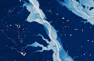
When you have a DEM, you will find mountains and valleys. Would you like to find out more? Let’s make a relative elevation model.