When you have a DEM, you will find mountains and valleys. Would you like to find out more? Let’s make a relative elevation model.
Reveal floodplain with elative elevation model
DEMs tell you a details of the geography of the area. REM, relative elevation model reveal the floodplain clearly.
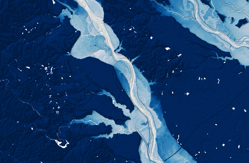 relative elevation model
Tools
- QGIS
Data sources
- DEM: 国土地理院基盤地図情報
- Centerline of streems: 国土数値情報
How to make
- Get a DEM and a line data of a stream centerline
- Construct pointa along the stream line with a proper dense
- Extract DEM values to the points
- Run IDW tool and create an interpolated raster from points
- Calculate Original DEM minus interpolated raster
Visualisation tricks
- As a base layer, lay hillshade
- Select multiply mode For the REM layer
- Strech the color gradation range relatively small like -2 to 20m to highlight the floodplain